Dr. Gabriel Williams
Associate Professor
Office: RITA 333
Phone: 843.953.0278
Email: williamsgj@cofc.edu
Home
Curriculum Vitae
Research
Mesoscale Analysis
TC Analysis
|
|
Archive Data
1. NHC Reconnaissance Archive: This archive contains all aircraft reconnaissnace data from North Atlantic and Eastern Pacific hurricanes since 1989. Chapter 5 of the National Hurricane Operations Plan explains aircraft reconnaissance data. In order to decode these data types, see Appendix G of the National Hurricane Operations Plan.
2. CIMSS Tropical Cyclones Data Archive: This archive, sponsored by the University of Wisconsin-Madison, contains detailed analysis data from TCs in all basins since 1998. The analysis products include:
- 200 mb, 500 mb, 700 mb, and 850 mb relative vorticity
- 200-700 mb, 250-850 mb, 300-850 mb, 400-850 mb, 500-850 mb, 700-850 mb deep layer mean steering
- Deep-layer and mid-layer shear
- Deep layer 24 hour shear tendency
- Low-level convergence and upper-level divergence
- Atmospheric Motion Vectors (AMVs)
- Visible, IR, and Water Vapor Satellite Imagery
- Microwave imagery can be found at MIMIC. This goes back to 2004.
- Forecast and observed track history
- Visible, IR, water vapor, and microwave satellite imagery
- Satellite surface and aircraft-based surface wind analysis
- Ocean heat content
- TC kinetic energy and intensity plots
- TC mean sea level pressure (MSLP) and maximum winds
- Digital Dvorak analysis
- ATMS and dropsonde soundings
- TC size and RMW
- Satellite based 34-kt, 50-kt, 64-kt wind radii estimates
- Area-averaged wind shears and layer means
Real-Time TC Guidance
There are a number of useful sites that provide real-time analysis of current TCs.1. Tropical Tidbits: This popular tropical meteorology page provides current numerical modeling guidance using global models (such as the GFS), ensemble models (such as the EPS), hurricane models (such as HWRF), mesoscale models (such as NAM).
2. NRL Tropical Cyclone Page: This page provides numerous satellite imagery channels.
3. Tropical Cyclone Radar Loops: This page, maintained by Brian McNoldy, contains ground=based radar loops of landfalling hurricanes.
Current Tropical Cyclone Activity
Here are the current tropical cyclone advisories for the North Atlantic and Eastern Pacific basins, courtesy of NHC and Bryan McNoldy's global tropical cyclone tracks.

|

|
| Current 2-day graphical tropical weather outlook for North Atlantic basin. | Current 2-day graphical tropical weather outlook for East Pacific basin. |

|

|
| Current Atlantic tropical cyclone activity. | Current Eastern Pacific tropical cyclone activity. |
Current Satellite Imagery
Here are current satellite loops of the North Atlantic and Eastern Pacific basins for the North Atlantic and Eastern Pacific, courtesy of NOAA and the National Environmental Satellite, Data, and Information Service (NESDIS).

|
|
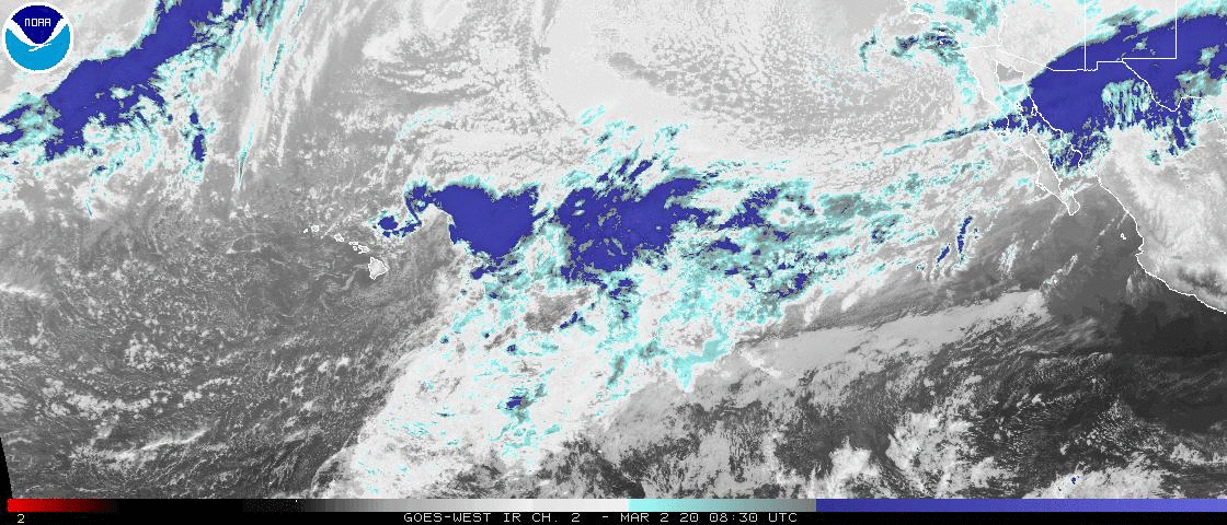
| Current shortwave IR loop for North Atlantic basin. | Current shortwave IR loop for North Pacific basin. |

|
|
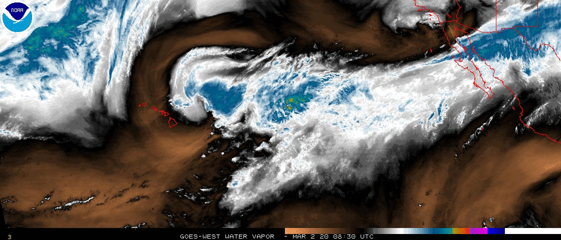
| Current water vapor loop for North Atlantic basin. | Current water vapor loop content for North Pacific basin. |
Current Ocean Observations
Here are the current ocean observations for the North Atlantic and Eastern Pacific, courtesy of the University of Miami Upper Ocean Dynamics Laboratory.

|

|
| Current oceanic heat content for North Atlantic basin. | Current oceanic heat content for North Pacific basin. |

|

|
| Current SST for North Atlantic basin. | Current SST for North Pacific basin. |

|

|
| Current depth of 20 degree Celsius isotherm for North Atlantic basin. | Current depth of 20 degree Celsius isotherm for North Pacific basin. |

|

|
| Current depth of 26 degree Celsius isotherm for North Atlantic basin. | Current depth of 26 degree Celsius isotherm for North Pacific basin. |
Current Tropical Synoptic Environment
Here are the current tropical synoptic observations for the North Atlantic and Eastern Pacific, courtesy of the CIMSS Tropical Cyclone team.

|
|
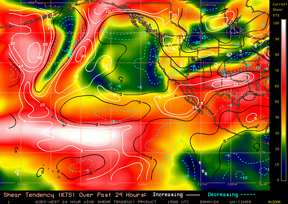
| Current 24-hour deep shear tendency in North Atlantic basin. | Current 24-hour deep shear tendency in East Pacific basin. |

|

|
| Current 24-hour deep shear in North Atlantic basin. | Current 24-hour deep shear in East Pacific basin. |
|
|
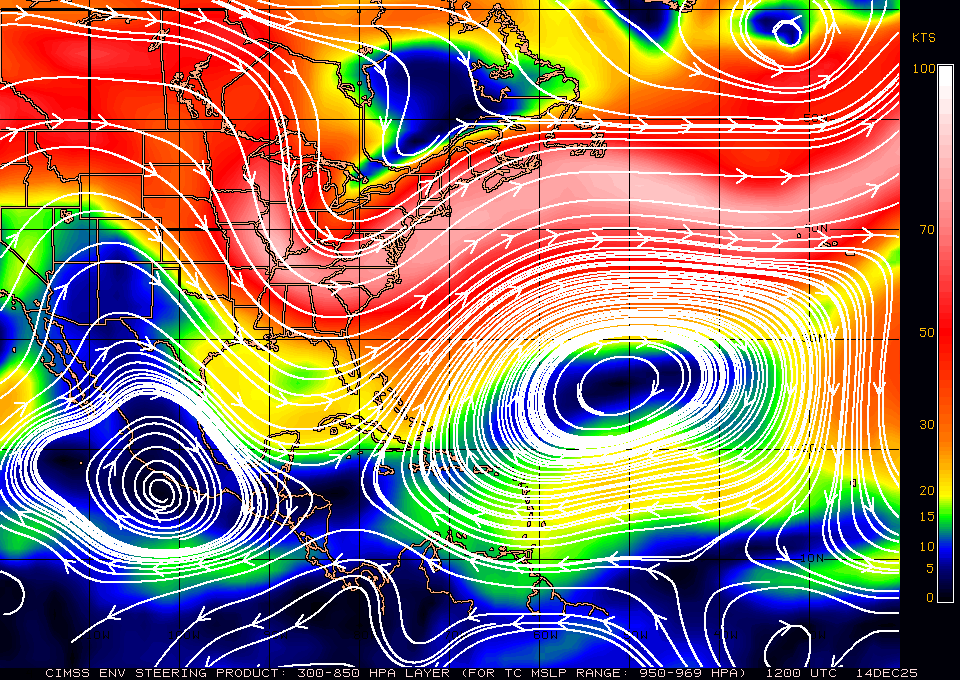
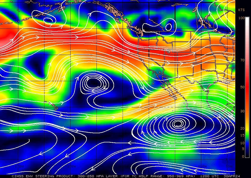
| Current 300-850 mb mean steering layer in North Atlantic basin. | Current 300-850 mb mean steering layer in East Pacific basin. |
|
|
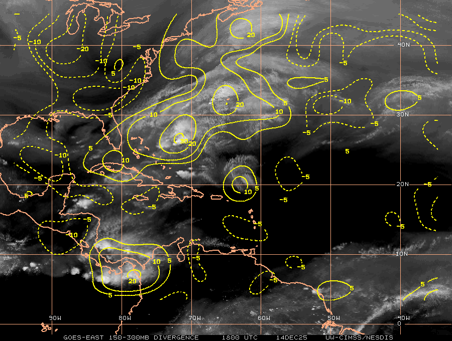
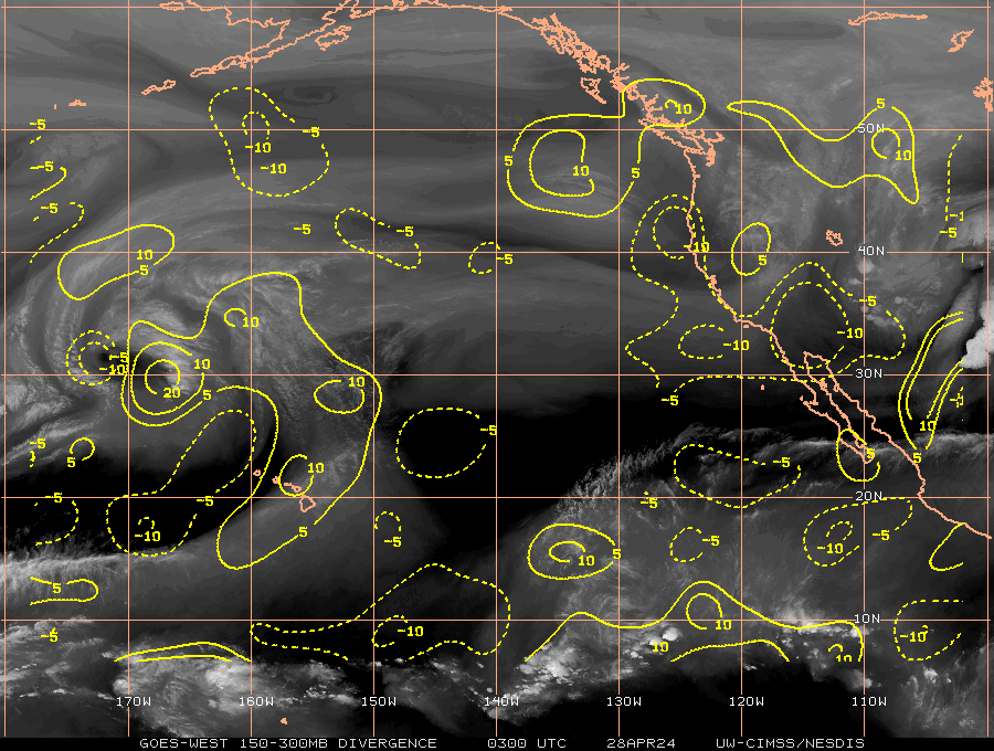
| Current upper level divergence in North Atlantic basin. | Current upper level divergence in East Pacific basin. |

|
|
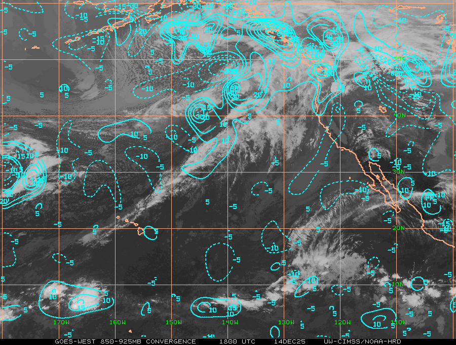
| Current lower level convergence in North Atlantic basin. | Current lower level convergence in East Pacific basin. |
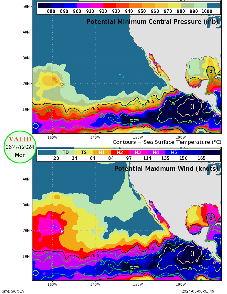
Here are the current potential intensity predictions, courtesy of GrADS/COLA.

|
|
| Current potential intensity for North Atlantic basin. | Current potential intensity for East Pacific basin. |
|
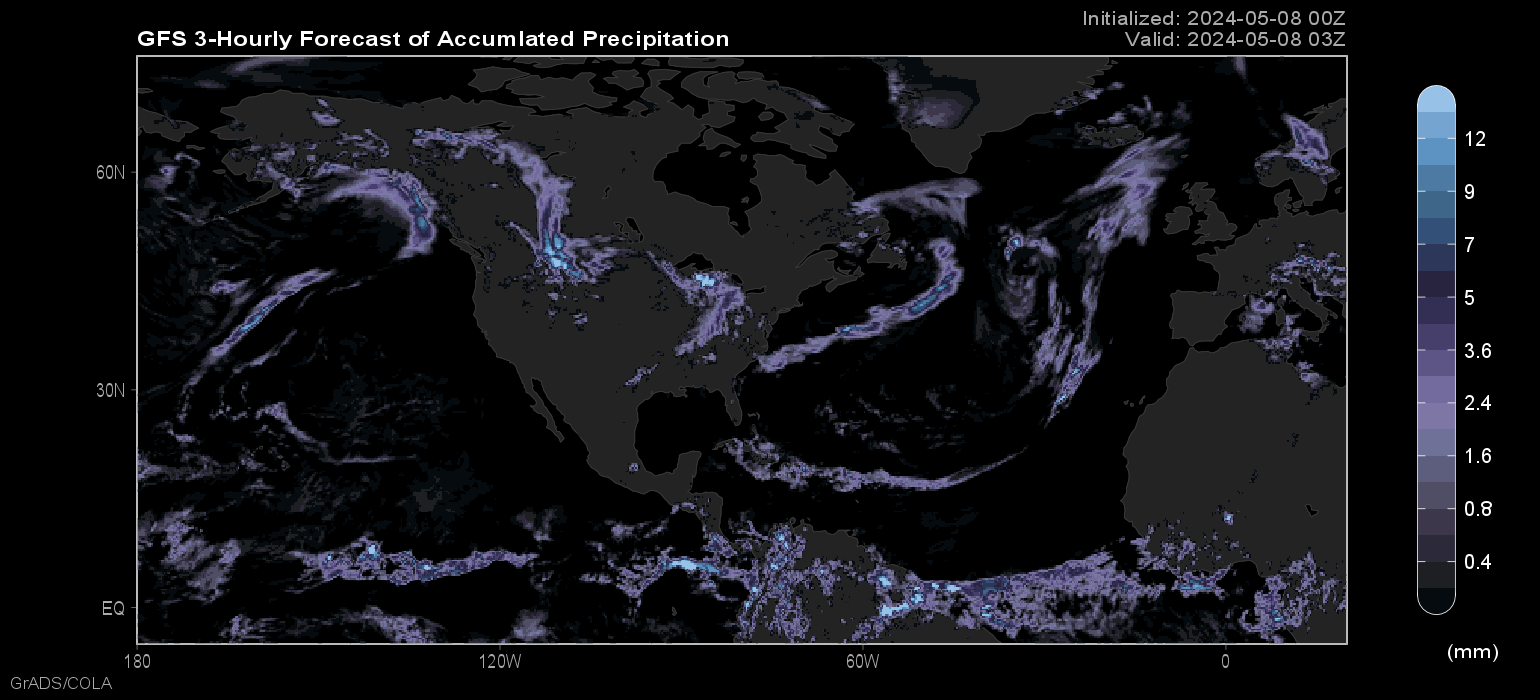
| GFS 3-Hourly Forecast of Accumulated Precipitation |